Politics and the English Landscape
I’m still playing around with the UK Election data I mapped yesterday, which ended up at the Monkey Cage blog over at the Washington Post. On Twitter, Vaughn Roderick posted a nice comparison showing the proximity of many Labour seats to coalfields.
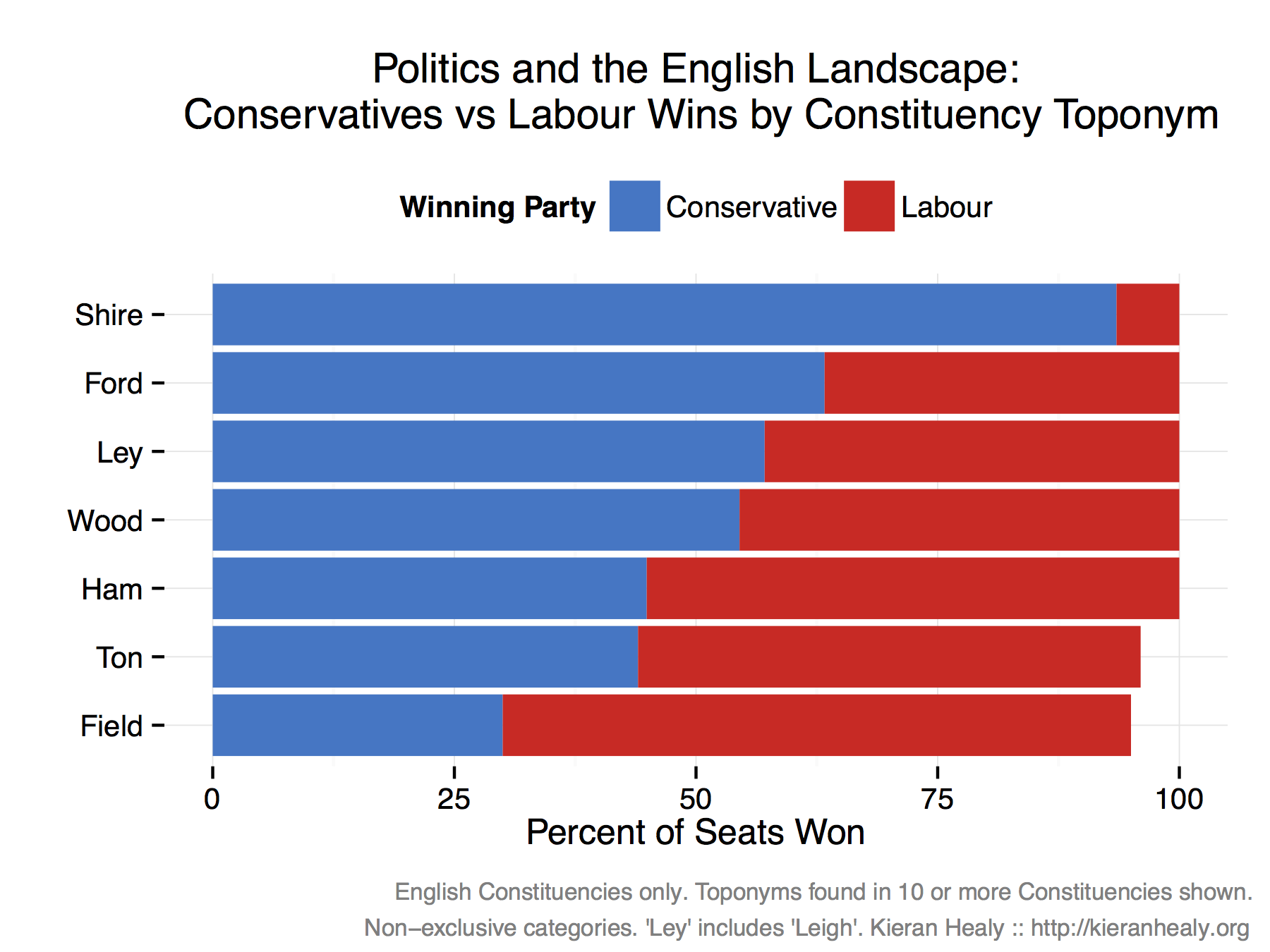
That got me thinking about how much the landscape of England is embedded in its political life. In particular, what do the names of places tell you about their political leanings? I looked at English constituencies only, and searched constituency names for some common toponyms like “-ham”, “-shire”, “-wood” and -field". Then I looked to see what proportion of seats with these features in their names were won by the Conservatives and Labour. For simplicity of presentation, I omitted the Liberal Democrats and UKIP who won a very small percentage of some of these seats. Here’s the result.
English Constituencies by Toponym and Winning Party.
I think that’s rather nice. The Tories are the party of shires and fords, and to a slightly lesser extent of woodland clearings (-ley, -leigh) and woods. Labour meanwhile are the party of -hams (as in, a farm or homestead), of -tons (or towns), and of fields.
Note that some double-counting occurs, because the naming categories are not necessarily exclusive. I did focus on suffixes, so for example “Northampton” would be counted as a -ton but not a -ham, and constituencies with ’ton’ in their name but not at the end of a word would not be counted in that category.