A New York City Adults and Children Dotmap
One more NYC dot-density map. Apart from a basic population count and the race/ethnicity data, about the only other block-level data we have from the 2020 decennial Census is information on the number of adults aged 18 and over. This is because the Census Bureau has to provide these counts quickly to Congress to allow for redistricting. Because we have the total count, we can infer the number of children (persons under 18 years). So here is a dot-density map of that.
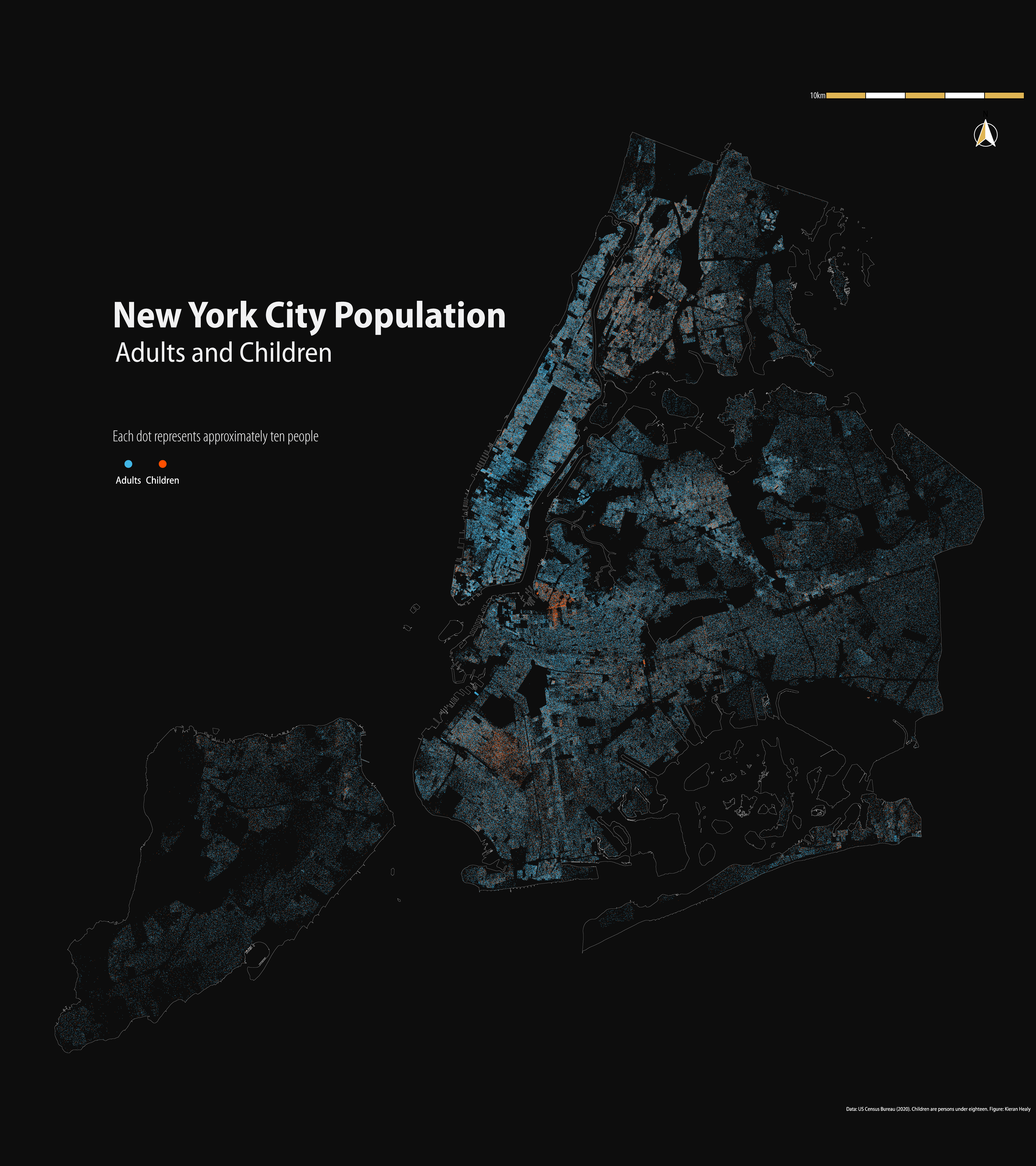
The distribution of adults and children in New York City in 2020
A higher-resolution PNG is available as well, weighing in at about 20MB.
The method is the same as described for earlier maps.